
Risan hinterland
It’s an area of deep karst, covered by thick deposits brought by the glaciers from Mount Orjen
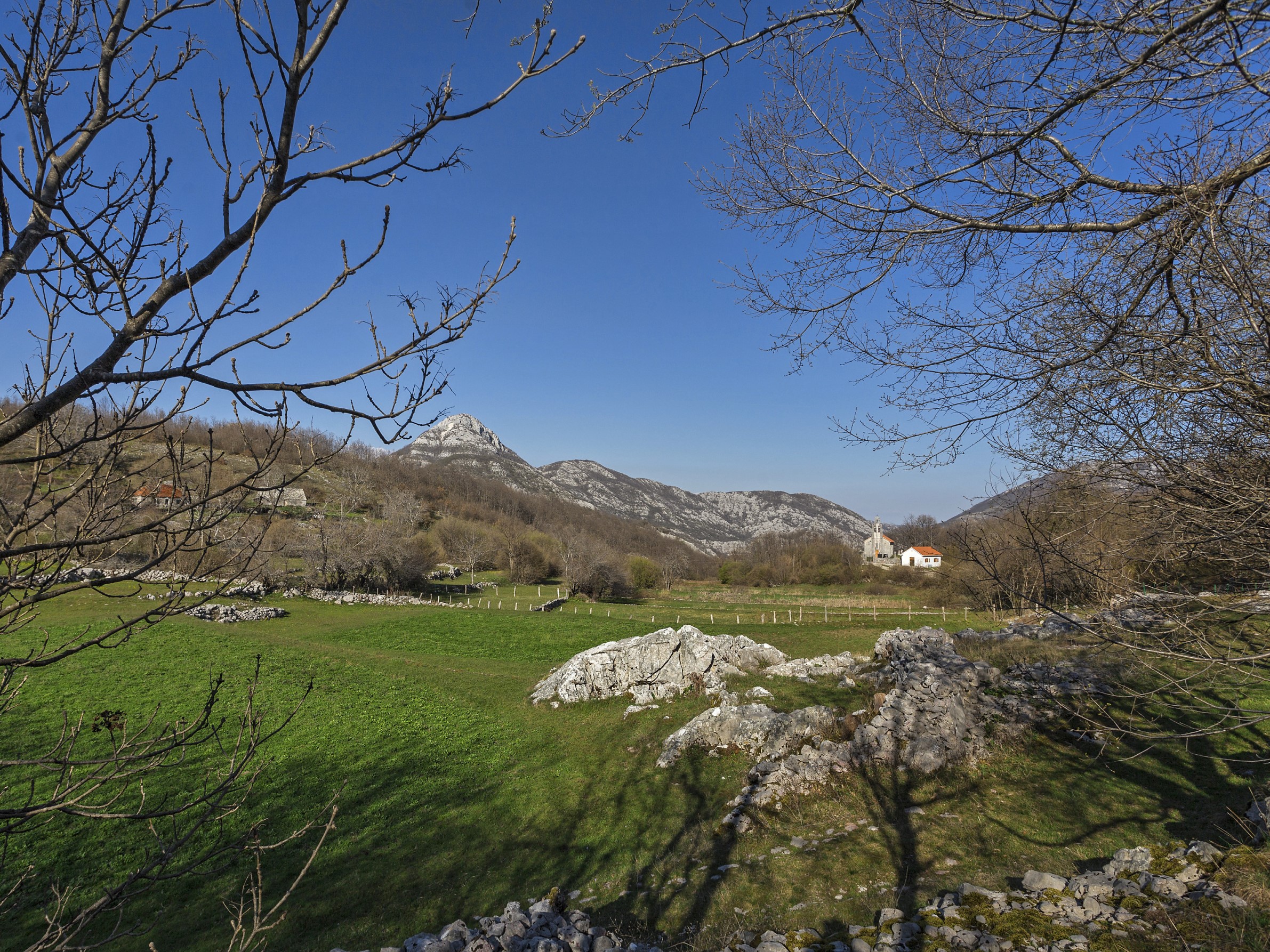
Krivošije plateau makes Risan hinterland, and it is an area of deep karst, covered by thick deposits brought by the glaciers from Mount Orjen (1895 m) coming down through its beds (waves) towards Dragalj and Grahovo. Krivošije plateau is covered in beech forests, which on higher slopes of Mount Orjen turn into Bosnian pine tree forests, typical representative of sub-Alpine climate. The village of Crkvice at Krivošije, lying 1 050 metres above the sea level, 5.8 kilometres of airline away from Risan, receives the greatest quantity of precipitations in Europe (5 317 mm), which is on average 2 101 mm more than the average recorded in Risan in the period between 1929–1940. In the eastern part of this plateau, there are two karstic valleys, Grahovo and Dragalj. Dragalj Valley stretches in the immediate hinterland of Risan, at the altitude of 600–660 metres above the sea, in the length of 6.5 kilometres and the width of up to 2.5 kilometres. Its area is about 8 km2. Despite great quantity of precipitations, around 3 000 mm/year, Dragalj Valley is dry and arid. The largest settlement is Dragalj, 27 kilometres away from Risan. By means of a low pass called Ljut, Drgalj Valley is connected to Grahovo Valley, which is surrounded by high mountains. It stretches in the length of 6.5 kilometres and the width of up to 1.5 kilometres. The bottom of the Valley is located at the altitude of 695–780 metres above the sea. The aridity in this valley is the consequence of the karstic relief.
By the year 1684, Krivošije had been under the Turkish rule, and then under the venetians up to 1797, when it falls under Austro-Hungarian rule. From 1807 to 1813, Krivošije is under the French rule, and then briefly under the Montenegrin dominion, only to fall once again under the rule of Austro-Hungarian Empire in 1814 until the establishment of Yugoslavia in 1918. This was a strategically very important part of Risan hinterland, which is testified, by its military character. Besides the very inhabitants of this area, its contents satisfied the needs of 7 000 soldiers. To illustrate, one should mention numerous shops, military training grounds, church, cinema, tennis courts, football pitch, bowling alley, school, Hotel “Crkvice”, and especially the military bakery, second in Europe by its capacity – it produced 24 tons of bread per day. During the World War II, famous twenty-day-long battle was fought at Ledenice, the birthplace to the national hero Savo Ilić, between the members of the First Boka Strike Brigade, the First Company of the Second Dalmatian Brigade, and the retreating German soldiers, in November 1944, after which Kotor was liberated on 21st November. The inhabitants of Krivošije continued leaving the area even after the World War II, as a consequence of the development of industry and marine shipping in the coastal settlements of Boka Kotorska Bay, but also in other places. In plain words, with the loss of strategic importance Krivošije also lost its population.